Turn marine uncertainty into operational advantage.
Site-specific marine forecasts and intelligence for offshore fleets, wind farms, oil & gas operations, dredging campaigns and subsea installation — calibrated to your assets, your thresholds, your contracts.
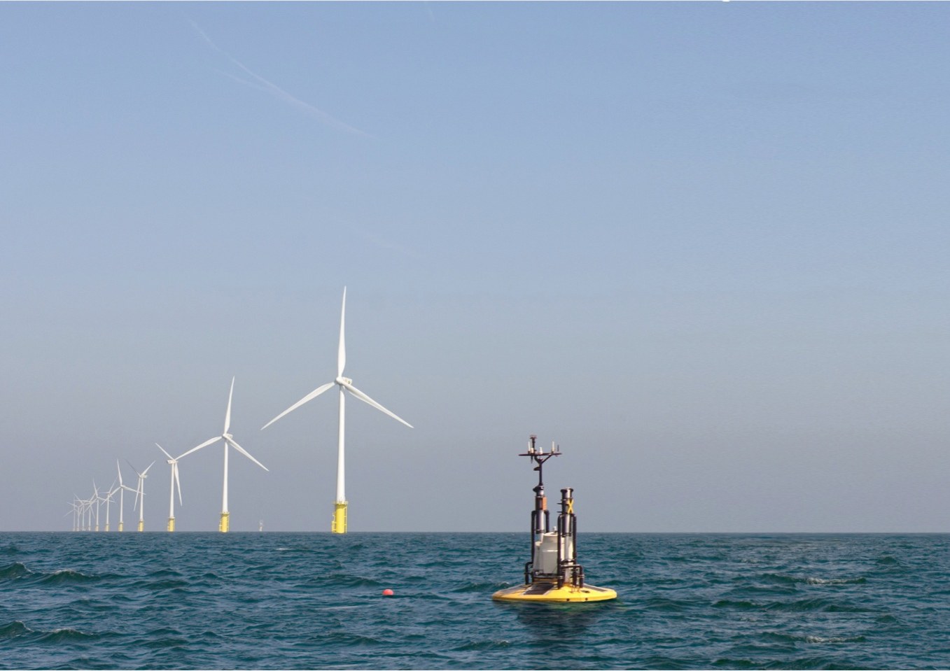
Sea state is the binding constraint on productivity.
Every day on an offshore asset costs hundreds of thousands of dollars — and a misjudged weather window costs more. Idle vessels, paused drilling, missed crew transfers, late installations, schedule penalties: when the marine environment closes a window, the costs cascade through the entire operation.
Standard public-domain metocean forecasts give a broad regional picture, but offshore operators need site-specific intelligence calibrated to their assets and operational thresholds. Wave height matters less than wave height relative to your specific operational limit. Current direction matters less than current direction relative to your moored asset's allowable orientation.
Beyond the day-to-day weather, less visible events can also disrupt operations: solitons, sediment plumes, and sudden current shifts — rarer than a misjudged weather window, but just as costly when they arrive.
Built for the operations that depend on the marine environment.
Resource assessment, construction window selection, crew transfer planning, O&M optimisation.
FPSO operations, drilling weather windows, soliton detection, subsea integrity protection.
Vessel routing, weather-window selection, anchor handling, heavy-lift scheduling.
Sediment-event forecasts, cable-lay window selection, pipeline installation, dredge productivity.
Three integrated solutions for offshore operations.
We combine in-situ buoys (including our Wind Lidar Buoy for offshore wind), satellite earth observation, and custom oceanographic models — calibrated to your specific asset, location, and operational thresholds.
Continuous metocean and water-quality data from our buoys (including offshore-wind Wind Lidar variants) or from sensors already on your vessels and platforms.
- · Wave height, period, direction
- · Wind speed, direction, gust
- · Current speed (surface + depth)
3-to-7-day forecasts of the metocean parameters governing your operations, with thresholds you define and alerts that reach the right people.
- · Site-specific weather windows
- · Soliton & sediment-event prediction
- · Categorised: safe / caution / warning
Historical metocean heatmaps for new asset siting, wind farm layout decisions, anchor analysis, and post-event diagnostic studies.
- · Up to 40 years of hindcast
- · Compare candidate sites objectively
- · Storm-window probability analysis
Predict the conditions that move your fleet.
Significant wave height, peak period, swell direction. Calibrated against your operational thresholds.
Speed, direction, gust profiles. Powered by Fugro Weather, the in-house 24/7 marine forecasting desk.
Surface + depth profiles. Critical for anchor handling, ROV operations, and subsea installation.
Sub-surface waves (Andaman Sea, others) + sediment-plume forecasts. The events public weather services miss.
What changes when every weather call is forecast-driven.
Site-specific forecasts identify more usable windows than regional forecasts allow. Vessels work more days. Idle time on standby falls. Day-rate productivity improves measurably across a season.
WOW (waiting on weather) is one of the largest hidden costs in offshore ops. Knowing 3–7 days out which windows hold up means crews, equipment and consumables are positioned right — instead of paying for them to sit.
Fewer marginal-condition operations means fewer near-misses, fewer injuries, fewer regulatory escalations. Crew transfer windows, helideck operations, and over-the-side work all benefit from accurate, asset-specific forecasts.
Contracts increasingly carry liquidated damages for missed milestones. Predictive scheduling around accurate forecasts protects the critical path — and your commercial position.
Predictive intelligence for solitons, sediment events and extreme metocean conditions lets you de-risk mooring loads, riser stress, subsea infrastructure exposure, and equipment positioning before the event arrives.
Crane operations, jack-up positioning, CTV transfers and helideck approaches all have strict sea-state thresholds. Forecasting which windows clear the threshold turns guesswork into planning.
Fleet operators running multiple assets across a region get a unified forecast view — coordinate vessel routing, anchor handling and supply runs around the same forecast horizon.
Continuous, documented marine intelligence supports environmental compliance reporting, insurance underwriting positions, and claim defence when incidents do occur.
Enhancing offshore asset safety with soliton early warnings.
ENI Krueng Mane's operations in the Andaman Sea face one of the world's most active regions for internal solitons — large sub-surface waves that produce sudden currents capable of overloading mooring lines, risers and subsea infrastructure.
SEAWATCH® combines satellite remote-sensing detection with custom propagation modelling to deliver days-of-advance notice before each event reaches the asset — turning a reactive scramble into predictive operations.
Read full case study →Ready to plan around the marine environment instead of fighting it?
30-minute discovery call. We map your operational thresholds to the marine parameters that drive them, and recommend whether SEAWATCH® is a fit.
Book a meeting