How SEAWATCH® buoys helped save lives during Cyclone Fani in India.
A Bay of Bengal cyclone. Hours to evacuate. Limited offshore data.
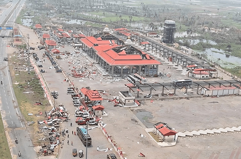
Cyclone Fani formed in the Bay of Bengal in late April 2019 and intensified rapidly into one of the strongest cyclones to threaten India's east coast in two decades — making landfall in Odisha state on 3 May 2019 with sustained winds exceeding 175 km/h.
Bay of Bengal cyclones are uniquely dangerous: shallow continental shelves amplify storm surge, dense coastal populations are highly exposed, and historical events have caused catastrophic loss of life. Authorities had hours, not days, to make evacuation decisions across hundreds of kilometres of coastline.
The forecasting challenge: accurate, real-time wind and wave observations from inside the cyclone's track — not just satellite-derived estimates. Without this ground truth, intensity and landfall predictions can drift in the final 24 hours, when every hour matters for evacuation logistics.
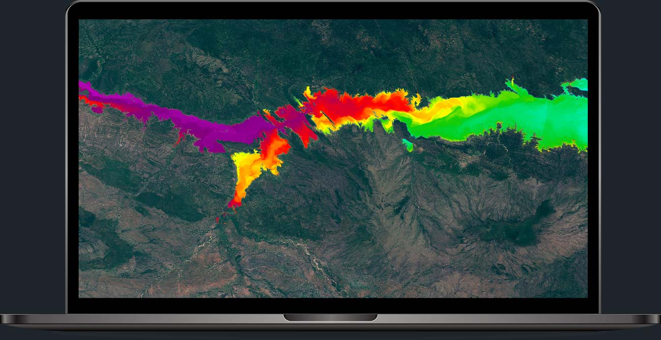
SEAWATCH® buoys: real-time eyes inside the storm.
SEAWATCH® buoys in the Bay of Bengal streamed wave height, wind speed, atmospheric pressure and currents in real time as the cyclone approached the coast.
In-situ measurements complemented satellite observations, providing the ground truth that improves track and intensity forecasts during the critical final 48 hours.
Calibrated forecasts enabled authorities to plan and execute one of the largest pre-emptive evacuations in modern history — clearing low-lying coastal districts before landfall.
One of the largest pre-emptive evacuations in history.
Need real-time marine data for emergency planning?
SEAWATCH® supports coastal authorities, port managers and offshore operators with continuous metocean intelligence. 30-minute discovery call, no commitment.
Book a meeting